A quick quiz. What do the following all have in common: Coyotes, snakes, deer, fox, ground squirrels, egrets, nesting herons, pheasants, jackrabbits, wild turkeys and turkey vultures, goats and sheep? If you answered that they are all animals, of course you would be correct.
But they also happen to be animals that I have personally seen and photographed along my favorite bike path that goes along the Napa River Bay Trail in American Canyon. The beauty of this route is that a) for the most part, you don’t have to worry about automobiles—much of my ride is along a hard dirt/gravel path that parallels the mouth of the Nap
a River as it reaches the bay between Napa and Vallejo; b) it’s flat as a pancake; c) you can turn around at any point you like, and d) you can stop and admire the views along the route.
And the views are spectacular. My 12-mile route starts near the American Canyon Police and Fire Station and I cross Highway 29 at Donaldson Way and continue on that road past the AC Middle School and the soon-to-be opened brand new Boys and Girls Club, to Wetlands Drive.
At Wetlands Drive, I turn right and ride to its end to the parking lot entrance to the Bay Trail. There I turn left and continue into that part of my ride in which cars are not allowed—a wonderful experience for walkers, hikers, and bicyclists who do not have to share the road with motorized vehicles.
Quickly you get to the old landfill area (the path around it was opened to the public several years ago) and I ride clockwise around that which is fenced in. At least once a year the city of American Canyon contracts with “Goats Are Us” to bring in a herd of goats to graze in this area to reduce the fire danger in the dry months. You can see more goats close up than you are likely to ever see anywhere else, when they are there!
On the far side of the landfill, I often see people fishing where the viewing turn out is, complete with viewing ‘pipes’ that allow you to see various mountains, including Mt. Tamalpais and Sonoma Mountain—well worth a short side tour.
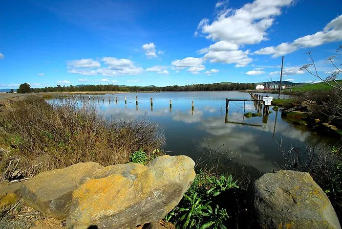
At the end of this loop, I turn left and then a quick right onto the path that takes you past one of the marsh areas (tons of migratory birds are visible at different times of the year to the right and left of the path and all along the trail as it skirts the bay.
At the end of this path I turn left across the footbridge and make a quick right and follow the trail all the way out to Green Island Road. Along the way there are several “informational” stops for viewing and a bench on which to rest and relax. At about mile 6, the dirt/gravel path ends and becomes a road again. I usually follow the road about .4 of a mile to the parking lot which parallels the Napa River. When I get to the parking lot (there is a public bathroom on the left side of the road), I turn around and retrace my route heading back.
As you get to the footbridge, you can go straight and continue to Glass Beach or turn and cross the footbridge and follow the path which takes you back to the parking lot entrance. However, if you cross the footbridge along that route, please stop if you can along what I call the green algae pond and notice the clumps of nesting night herons in the reeds there. Recently a friend and I estimated there are more than 100 of these magnificent birds to be seen. If you bring binoculars, you can get an amazing close up of many of them. To my knowledge there is no other place in northern California which offers such a breathtaking view of these rarely seen birds. It alone is worth the trip. It is nature at its finest, it’s free and it’s safe. What more could you ask for?